
Different points of view
Yesterday, we focused on collecting instruments used to measure the ice sheet's motion, lake water levels, and surrounding air temperatures. Today, the focus was on ground-truthing—using our eyes and cameras to record things that we can't see with a seismic record, thermometer, or even with satellite images. The easiest way to investigate the ice sheet is by walking around and recording what we see. The team also flew helicopter surveys to see the ice from above. And for an even broader view, we have images of the lakes recorded from space satellites.
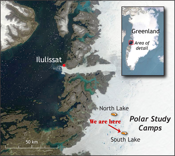
When the helicopter returned this morning, I joined the science team on an hour-long aerial survey of 20 nearby lakes. The perspective immediately allowed us to do things we can’t from ground—look at water levels in the lakes and count the number of channels flowing into the lakes. The weather cleared during the survey, and we soaked in magnificent views of the glacial lakes—some full, some empty, some draining.
The helicopter brought temporary visitors Mary Miller and Lisa Strong-Aufhauser from the Exploratorium museum in San Francisco. They are interviewing scientists in the field for their National Science Foundation-funded project “Ice Stories.” Their interviews with us will be available at http://www.exploratorium.edu.
Read on about our adventure in the slideshow below. Can't see the slideshow? Get the Flash plug in »