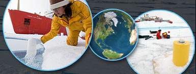
Arctic: Location and Geography
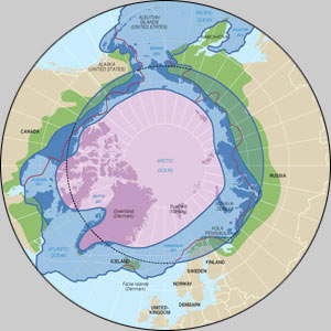
The Arctic is named for the north polar constellation “Arktos”—Greek for “bear.” It is 14.5 million square km (5.5 million square miles)—almost exactly the same size as Antarctica—and has been inhabited by humans for close to 20,000 years. It consists of the ice-covered Arctic Ocean and surrounding land, including all of Greenland and Spitsbergen, and the northern parts of Alaska, Canada, Norway, and Russia. Its boundary is defined by either the northern limit of stands of trees on land (the treeline), the line of average July temperature of ~10°C (50°F), or the Arctic Circle, an imaginary line of latitude located at 66 degrees 33 minutes North. North of this line, the sun never sets on the summer solstice (June 21st).
Some of the land parts of the Arctic, like Greenland, are covered with ice sheets; others, like Alaska, have lush tundra. These areas have large mammals, such as caribou, bears, wolves and foxes, and a variety of plants. In summer, migratory birds and other wildlife come to the Arctic to raise their young.
The size and shape of the Arctic Ocean Basins are roughly similar to those of the Antarctic continent, and is 1.5 times the size of the continental US. It is also very deep, reaching more than 4,000 meters (13,000 feet or 2½ miles) in some areas. It is mostly covered by pack ice (frozen seawater) averaging 2-3 meters (6-10 feet) thick. The ice drifts around the polar basin under the influence of winds and currents. When the floes collide, the ice forms a jagged line of ice chunks known as a pressure ridge.
The Arctic Ocean seafloor is subdivided by three great parallel mountain ranges, or ridges, between Greenland and Siberia. The Nansen-Gakkel Ridge (Arctic Mid-Ocean Ridge), an active seafloor spreading center, stretches across the basin north of western Russia. The Pole Abyssal Plain, an elongated trough of flat seafloor, lies between the Arctic Ridge and the Lomonosov Ridge, an underwater mountain chain that averages 3,048 meters (10,000 feet) high above the abyssal plain and in places comes to within 914 meters (3,000 ft) of the surface. On the Canadian side of this ridge the Fletcher and Wrangel Abyssal plains form a deep, irregular basin between the Lomonosov and the Alpha Ridges. Between Canada and the Alpha Ridge lies the largest of the Arctic sub-basins, the Canada Abyssal Plain, a sweeping, broad area with an average depth of 3,658 meters (12,000) feet that includes much of the Arctic Ocean.