The Arctic: Exploration Timeline


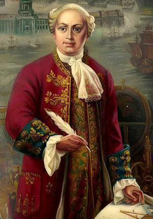
Portrait of M. Lomonosov. Image courtesy Ecoshelf.

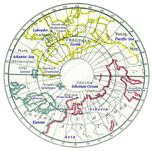
Lomonosov's map of the Arctic. Image courtesy Ecoshelf.
1725-1742
In 1732, the Russian Admiralty organized the Great Northern Expeditions both on land and at sea to find the Northeast Passage along the coast of Siberia. Overseen by Vitus Bering, the expeditions mapped thousands of kilometers of the coast of Siberia for the first time, discovering numerous bays, gulfs, capes and islands. Many geographical features are named after the Naval officers who led the explorations, such as Cape Cheluskin, Malygin Strait, Cape Ovtsyn, Cape Skuratov, and Cape Steligov.
The Russian physicist and philosopher, Mikhail Lomonosov, participated in the Great Northern Expeditions for 20 years. He organized special polar explorations, supplying each vessel with physical and astronomical instruments, teaching navigators to make physical measurements, and developing ship logs and meteorological log books. From this information, he suggested a scheme of currents in the Arctic Ocean, classified sea ice types, and explained the role of the sun as a source of heat in the Arctic. He also made a map of the Arctic with ocean at the North Pole—an idea not the generally accepted at the time.
« Previous Page | Next Page »

